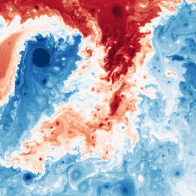
SATELLITE OBSERVATIONS OF THE OCEAN ARE CHALLENGING because of the spatial and temporal sparseness of the available data. With collaborators Shafer Smith and Andrew Majda at New York University, I have been developing new methods for obtaining superresolved satellite images from low-resolution observations. The method works by exploiting the effect of spatial aliasing to generate an optimal estimate of small-scale features using standard Bayesian inference. A novel feature of the method is the use of an efficient stochastic parameterization for the unresolved scales modeled on statistical information.
S.R. Keating and K.S. Smith (2015).
Upper ocean flow statistics from superresolved sea-surface temperature images.
J. Geophys. Res. 120(2): 1197-1214. link
S.R. Keating, A.J. Majda and K.S. Smith (2012)
New methods for estimating ocean eddy heat transport using satellite altimetry.
Monthly Weather Review 140(5): 1703-1722 link
